Hiking Mt. Onigashiro(737m) & Mt. Nakao(798m)
About Mt. Onigashiro & Mt. Nakao


- Location:Kamifukawacho, Hiroshima Asakita-ku, Hiroshima, Japan
- Nearest Station: JR Kamifukawa Station
- Elevation: Mt. Onigashiro(737m), Mt. Nakao(798m)
Mt.Onigashiro and Mt.Nakao are located at west part of Hiroshima city. From Hiroshima station, it take about 30 minutes to Kamifukawa station, and cost 330 Yen(about $2.5).
About the hiking trail

- Distance of the trail: 8.4km
- Cumulative elevation difference: 965m
- Total time: 4h33m (Rest 58m)
- Calories consumed: 2201kcal
- Date: 24 April 2022
A hiking course starting from Kamifukawa Station.
Since Mt. Onigashiro is close to Mt. Siraki, which is famous among local hikers for its steep path, the path to the summit are also very steep. Many hikers traverse from Mt. Siraki to Mt. Onigashiro not just to enjoy the view, but to train their strength to prepare for more higher mountains.
Hiking to the summit

We start hiking from Kamifukawa Station. There were five members in all. Every one was wearing a mask until they get off the train to avoid Covid-19 infection.
In Japan, its not mandatory to wear a mask in public, but some how, 99.99% of Japanese voluntarily wears a mask. I guess its a common nationality to do the same as what majorities are doing.

It was raining in the morning, but after around 12 p.m. the weather condition has recovered, and we were able to hike in a nice weather condition.

The mountain path was in a good condition than we have expected. It seems local Alpine Club are maintaining the path.

A guide board by SANKIKAI, the local Alpine Club which means Three Demon Association in direct translation. In Japanese, I think its a cool naming. It says 70 more minutes to the summit of Mt.Onigashiro, and 35 more minutes to the 20 jou rock view point.

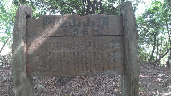
The summit of Mt. Nakao.
There was a Radio tower of NTT and we were unable to go near the summit.

There were no view from the summit of Mt. Onigashio and Mt. Nakao, because of the surrounding trees. However, the view from 20 Jou Rock view point was excellent!!

Since the mountain were steep, we took a long rest several times.
Very nice mountains and good for training the strength.
Comments
Post a Comment